client

Unmanned Aerial Vehicles (UAV) such as drones could soon enhance the data-driven agriculture with fleets or swarms of autonomous drones for monitoring tasks but also for active work such as crop spraying or planting. A self-initiated interface concept presents some visual ideas.
Team
Sebastian Lühr (Sadowski)
Release
March 2017
Interested? read
Intro
Introducing a drone Air-Traffic System
Delivered real-time data could visualize patterns exposing irrigation problems to soil variation or pest, bacterial and fungal infections.
Besides precise satellite pictures, airborne cameras could provide hyper spectral, multi spectral and thermal images to analyze healthy/distressed plants, chlorophyll- and nitrogen-levels, and more.
All drones assign their tasks autonomously and the user adjusts the spraying and fertilizing strategy.
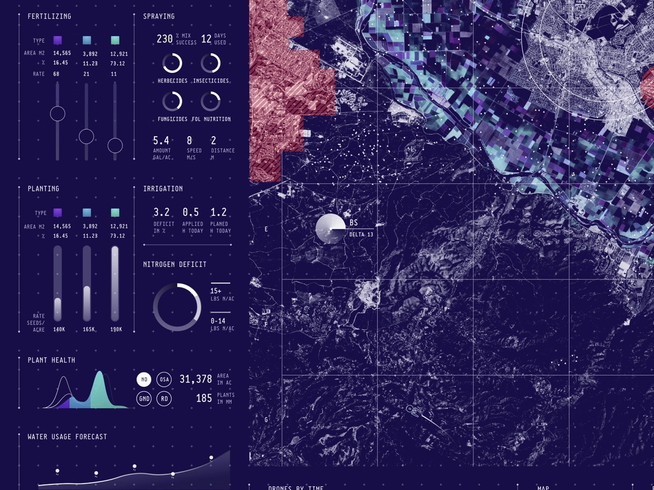
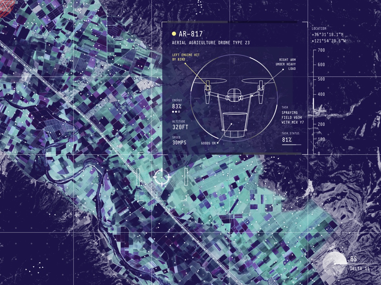
The user will be informed about unforeseen events and can intervene accordingly.


Get in touch to discuss what we could do for you.
© DataDesign Studio 2022. . All rights reserved.
For company information and other legal bits, see our legal page and Privacy Policy.